Aerial imaging is transforming crop production and land management. By providing real-time imagery of crops and fields, aerial imaging allows farmers and agricultural professionals to inform agricultural practices and maximize yield. The coming decades will be marked by integrating new tools, methods, and aerial imaging analyses that can be used to stabilize food security in a changing world.
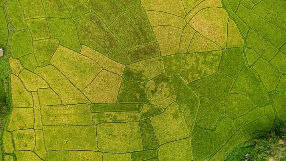
Image Credit: atk work/Shutterstock.com
History and modern tools for aerial imaging in agriculture
Modern agriculture is undergoing a radical transformation due to the use of digital technologies. Technological innovations have revolutionized agricultural practices, from automated machinery to deep learning analytical algorithms used to predict crop water requirements. Of particular importance has been the use of aerial machinery in agriculture.
The first instances of aerial applications in agriculture appear to be in 1906 when John Clervaux Chaytor spread seeds in New Zealand using a hot air balloon. By the 1920s, planes were being used for crop dusting by the US Agriculture Department in Ohio. A century later, farmers are using automated drones, remote sensing satellites, weather balloons, and various other aerial instruments for agricultural purposes.
The US Federal Aviation Administration forecast that from 2019 to 2038, agriculture will be the sixth industry with the most amount of unmanned aerial vehicle (UAV) missions. This acceleration in aerial agricultural technology has provided stakeholders with a range of benefits, from seeding to watering or harvesting. As a result of the effectiveness and affordability of UAVs, agriculture is undergoing a radical transformation driven by aerial technologies.
Aerial imaging refers to imagery taken from an aircraft or aerial platform and has significant potential in agriculture. The range of aerial tools used in agriculture was reviewed by Cerro et al., 2021 who discussed the agronomical use of UAVs according to their types and sensory capabilities. The authors presented how modern UAVs used in agriculture, particularly drones, range from smaller quadcopter designs to larger drones integrating multiple cameras as well as larger rotors and batteries for prolonged flight times.
However, regardless of design, most drones currently offer multispectral imagery techniques, photo and video settings, and automated settings allowing users to determine flight courses to run automatically at pre-set intervals and distances. Additionally, several machine learning algorithms and programs are available to analyze images in real-time or post-collection, providing information on spatial characteristics such as land usage or more fine-scale information on crop health or vegetation.
Current improvements and innovation trajectories for aerial imaging
In recent years, the increased availability, applications, and effectiveness of aerial vehicles in agriculture have led to many innovations and improvements. Due to the low cost of vehicles, certain cameras were ineffective for imaging on different terrain types. However, researchers quickly developed multispectral images trained on different data sets to improve accuracy, which allowed greater flexibility and up to 90% more accurate imaging (Chen et al., 2020).
Technological improvements in imagery allowed to reduce labor and time to facilitate the mapping of agricultural areas on gradually broader scales. Innovations focused on developing and improving vehicles for drones that would include longer-lasting batteries, better cameras, and better analytical tools. Accessible and easily operable programs are becoming increasingly common and are based on machine learning algorithms that can then be used to facilitate farming practices.
Analytical progress is also being accelerated through mapping databases such as Agriculture-Vision, a large-scale aerial farmland image dataset for agricultural patterns developed by Chiu et al. in 2020. The dataset consists of nearly 100 000 aerial images of different farmlands that allows computational models to recognize specific patterns in field types that are important to farmers. Agriculture-Vision allows farmers to identify issues related to irrigation, soil fertility, pest infestations, or nutrient deficiencies, and one of many databases provides analytical data to help farmers maximize yields.
Challenges and limitations to aerial imaging
Due to the decrease in costs of equipment such as drones, rising accessibility of public satellite data, and availability of associated computer programs providing effective analyses, aerial imaging will likely be used in agriculture increasingly often in coming decades. As a result, the hardware and software associated with aerial imaging methods will play a significant role in future farming systems. However, certain limitations may hinder the progress of aerial imaging in agriculture.
Specifically, the study by Cerro et al. discussed the legislation surrounding civilian drones, which are applied to and affects the use of drones in agriculture. Every country's regulations differ, yet certain restrictions may limit agricultural drone use. For instance, in the US, drone pilots must keep the drone within line of site to avoid collision with people or buildings, preventing farmers in large open spaces from flying over larger fields.
Policies are gradually changing with specific rules for using UAVs and other aerial imaging tools in agriculture, which could help stakeholders rely more on aerial methods. In turn, this may help overcome other issues that farmers are facing when deploying aerial imaging techniques, as it would allow the collection of more data. Collecting more data of different types over time will improve elements of machine learning, including the recognition of different terrain patterns, crop types, or temporal trends.
Ultimately, aerial imaging is an important element of modern farming systems. The widespread use of drones in recent years has propelled aerial imaging forwards, which will likely continue in the coming decades. Aerial imaging may therefore play a significant role in securing food production in an era of global environmental change and growing demands for food.
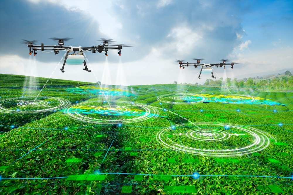
Image Credit: Suwin/Shutterstock.com
Sources:
- Anand, T., Sinha, S., Mandal, M., Chamola, V., & Yu, F. R. (2021). AgriSegNet: Deep Aerial Semantic Segmentation Framework for IoT-Assisted Precision Agriculture. IEEE Sensors Journal, 21(16), 17581–17590. https://doi.org/10.1109/jsen.2021.3071290
- Chen, P. C., Chiang, Y. C., & Weng, P. Y. (2020). Imaging Using Unmanned Aerial Vehicles for Agriculture Land Use Classification. Agriculture, 10(9), 416. https://doi.org/10.3390/agriculture10090416
- Del Cerro, J., Cruz Ulloa, C., Barrientos, A., & De León Rivas, J. (2021). Unmanned Aerial Vehicles in Agriculture: A Survey. Agronomy, 11(2), 203. https://doi.org/10.3390/agronomy11020203
- Saldana Ochoa, K., & Guo, Z. (2019). A framework for the management of agricultural resources with automated aerial imagery detection. Computers and Electronics in Agriculture, 162, 53–69. https://doi.org/10.1016/j.compag.2019.03.028
Further Reading
Last Updated: Nov 4, 2024